Falamar Hills: Difference between revisions
From Drunkapedia
imported>An Adventurer (New page: The exact defined areas of the Falamar hills are unknown. The famous early leader of the Gharu'ndim people, Musansayn, made peace with the Aluvians and arranged for his people to live ...) |
imported>Arkalor's Bot m (→Images) |
||
| (6 intermediate revisions by 2 users not shown) | |||
| Line 1: | Line 1: | ||
The exact | {|align=right | ||
|__TOC__ | |||
|[[File:Falamar Hills.jpg|thumb|Falamar Hills]] | |||
|} | |||
=== Description === | |||
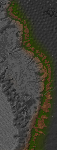
The exact location of the Falamar Hills is never described in detail. The famous early leader of the Gharu'ndim people, [[Musansayn]], made peace with the Aluvians and arranged for his people to live west of the Falamar Hills. There, he founded Samsur in the [[Yushid Ridge]], the first Gharu'ndim settlement.<sup>[[{{PAGENAME}}#References|<nowiki>[</nowiki>1<nowiki>]</nowiki>]]</sup> An early map of Dereth places the Falamar Hills between [[Zaikhal]] and [[Glenden Wood]], west of the [[Mount Alphus Range]].<sup>[[{{PAGENAME}}#References|<nowiki>[</nowiki>2<nowiki>]</nowiki>]]</sup> This likely makes the Falamar Hills the line of dry dirt hills that divides the [[Plains of Gaerwel]] from the drier desert regions of [[Middle Osteth]]. | |||
=== Route === | |||
* Use a [[Desert Ridge Border Portal]] | |||
=== Related [[Quests]] === | |||
* [[Simulacra Infiltrators]] | |||
* [[Spear of the Given Heart Quest]] | |||
* [[Undead Mechanic Quest]] | |||
=== [[NPCs]] === | |||
{{NPC Table | |||
| Table Rows = | |||
{{NPC Row | |||
| NPC Name = Desert Archmage | |||
| Location = [[31.5S, 37.1E - Archmage Tower|31.5S, 37.1E]] | |||
| Type = Shopkeeper | |||
| Details = Magical supplies | |||
}} | |||
{{NPC Row | |||
| NPC Name = Kayna bint Iswas | |||
| Location = [[Kayna bint Iswas' Home|1.7S, 36.6E]] | |||
| Type = Quest | |||
| Details = [[Silifi of Crimson Stars]] | |||
}} | |||
}} | |||
=== [[Points of Interest]] === | |||
{|border=0 cellpadding=3 | |||
| | |||
* [[2.3N, 27.8E - Skeleton Tower]] | |||
| | |||
* [[31.5S, 37.1E - Archmage Tower]] | |||
| | |||
* [[Aia's Tower]] | |||
| | |||
* [[Desert Ridge Border]] | |||
|- | |||
| | |||
* [[Kayna bint Iswas' Home]] | |||
| | |||
* [[Nuhmudira's Mansion]] | |||
| | |||
|} | |||
=== [[Portal]]s === | |||
* [[31.5S, 37.1E - Archmage Tower|31.5S, 37.1E]] - [[Heartland Portal]] | |||
=== [[Dungeons]] === | |||
{{Dungeon Table | |||
| List Quests = Yes | |||
| Table Rows = | |||
{{Dungeon Maps | |||
| Dungeon = Abandoned Arena | |||
| Coordinates = 11.3S, 37.4E | |||
| Wiki Map File = | |||
| ACmaps ID = 01A8 | |||
| Related Quests = None | |||
}} | |||
{{Dungeon Maps | |||
| Dungeon = Enkindled Souls | |||
| Coordinates = 49.4S, 26.9E | |||
| Wiki Map File = | |||
| ACmaps ID = 0141 | |||
| Related Quests = [[Undead Mechanic Quest]] | |||
}} | |||
{{Dungeon Maps | |||
| Dungeon = Nuhmudira's Dungeon | |||
| Coordinates = 4.0S, 35.9E | |||
| Wiki Map File = | |||
| ACmaps ID = 536D | |||
| Related Quests = [[Lunnum's Return]] | |||
}} | |||
{{Dungeon Maps | |||
| Dungeon = Southern Infiltrator Keep | |||
| Coordinates = 52.3S, 24.9E | |||
| Wiki Map File = | |||
| ACmaps ID = 03A2 | |||
| Related Quests = [[Simulacra Infiltrators]] | |||
}} | |||
{{Dungeon Maps | |||
| Dungeon = Tower Base Dungeon | |||
| Coordinates = 34.7S, 33.6E | |||
| Wiki Map File = | |||
| ACmaps ID = 5647 | |||
| Related Quests = [[Spear of the Given Heart Quest]] | |||
}} | |||
}} | |||
=== Images === | |||
<gallery widths=200px heights=200px perrow=4> | |||
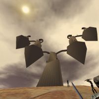
File:Aia's Tower Live 2.jpg|Aia's Tower | |||
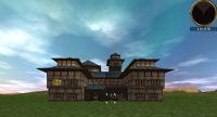
File:Nuhmudira's Mansion Live.jpg|Nuhmidira's mansion | |||
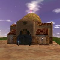
File:Kayna bint Iswas' Home Live.jpg|Kayna bint Iswas' Home | |||
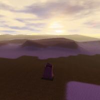
File:Desert Ridge Border Live 2.jpg|Desert Ridge Border | |||
</gallery> | |||
== References == | == References == | ||
# 1999/11 - '' | # 1999/11 - ''[[Asheron's Call Manual]]'', pg. 27 | ||
# 1999/?? - ''Lands of Asheron'' | # 1999/?? - ''[[Lands of Asheron Magazine Tear-out]]'' | ||
[[Category:Geographic | [[Category:Geographic Areas]] | ||
Latest revision as of 13:03, 12 January 2015
 |
Description
The exact location of the Falamar Hills is never described in detail. The famous early leader of the Gharu'ndim people, Musansayn, made peace with the Aluvians and arranged for his people to live west of the Falamar Hills. There, he founded Samsur in the Yushid Ridge, the first Gharu'ndim settlement.[1] An early map of Dereth places the Falamar Hills between Zaikhal and Glenden Wood, west of the Mount Alphus Range.[2] This likely makes the Falamar Hills the line of dry dirt hills that divides the Plains of Gaerwel from the drier desert regions of Middle Osteth.
Route
Related Quests
NPCs
| NPC Name | Location | Type | Details |
| Desert Archmage | 31.5S, 37.1E | Shopkeeper | Magical supplies |
| Kayna bint Iswas | 1.7S, 36.6E | Quest | Silifi of Crimson Stars |
Points of Interest
Portals
Dungeons
| Dungeon | Coordinates | Wiki Map | ACmaps | Quests |
|---|---|---|---|---|
| Abandoned Arena | 11.3S, 37.4E | -- | 01A8 | None |
| Enkindled Souls | 49.4S, 26.9E | -- | 0141 | Undead Mechanic Quest |
| Nuhmudira's Dungeon | 4.0S, 35.9E | -- | 536D | Lunnum's Return |
| Southern Infiltrator Keep | 52.3S, 24.9E | -- | 03A2 | Simulacra Infiltrators |
| Tower Base Dungeon | 34.7S, 33.6E | -- | 5647 | Spear of the Given Heart Quest |
Images
-
Aia's Tower
-
Nuhmidira's mansion
-
Kayna bint Iswas' Home
-
Desert Ridge Border
References
- 1999/11 - Asheron's Call Manual, pg. 27
- 1999/?? - Lands of Asheron Magazine Tear-out
