Category:Area Maps
From Drunkapedia
Media in category "Area Maps"
The following 114 files are in this category, out of 114 total.
-
0x050023DB.png 256 × 128; 13 KB
-
0x0500241D.png 256 × 256; 39 KB
-
A'mun Desert.jpg 394 × 517; 47 KB
-
Ac vod.gif 720 × 732; 130 KB
-
ACDM Redist Map.jpg 800 × 800; 93 KB
-
Aerlinthe - East and West Shore.png 238 × 240; 28 KB
-
Aerlinthe - Harbor.png 238 × 240; 28 KB
-
Aerlinthe - North Shore.png 238 × 240; 22 KB
-
Aerlinthe - Shimena Keep.png 238 × 240; 20 KB
-
Aerlinthe - Tenkarrdun and Lava Floes.png 238 × 240; 29 KB
-
Aerlinthe.jpg 250 × 250; 46 KB
-
Antique Map of Ispar Labeled.jpg 675 × 900; 354 KB
-
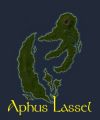
Aphus Lassel Map.jpg 839 × 1,079; 112 KB
-
Aphus Lassel Small.png 221 × 279; 18 KB
-
Aphus Lassel.jpg 250 × 300; 56 KB
-
Asheron's Island Map.jpg 273 × 245; 10 KB
-
Asheron's Island.jpg 250 × 250; 48 KB
-
Assassin's Roost Floor Puzzle.gif 350 × 120; 3 KB
-
Avalelle Island Map.jpg 354 × 256; 20 KB
-
Ayan Reflection Map.jpg 375 × 451; 11 KB
-
Beta Dereth.jpg 400 × 400; 50 KB
-
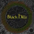
Black Hills.jpg 300 × 300; 73 KB
-
Blackmire Swamp Map.jpg 452 × 337; 32 KB
-
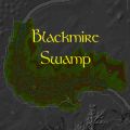
Blackmire Swamp.jpg 300 × 300; 74 KB
-
Caul island.gif 966 × 619; 175 KB
-
Caul Map.jpg 240 × 218; 11 KB
-
Caul Original Map.jpg 142 × 150; 7 KB
-
Caul rares map.jpg 360 × 370; 114 KB
-
Corcosi Island.jpg 232 × 241; 9 KB
-
Dark Isle.jpg 250 × 300; 45 KB
-
Dereth High.png 926 × 926; 355 KB
-
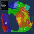
Dereth Spawn Distribution.jpg 900 × 900; 121 KB
-
Dereth SW Corner May 2010.png 900 × 600; 26 KB
-
Dereth.jpg 2,048 × 2,048; 4.43 MB
-
Direlands Midland Map.jpg 328 × 218; 14 KB
-
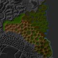
Direlands Midlands.jpg 300 × 300; 53 KB
-
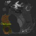
Direlands.jpg 400 × 400; 69 KB
-
East Direlands Swamps.jpg 525 × 525; 72 KB
-
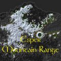
Esper Mountain Range.jpg 300 × 300; 66 KB
-
Falamar Hills.jpg 244 × 633; 58 KB
-
Guardian of Mhoire Room Flames Map.png 282 × 273; 2 KB
-
Halaetan Geography.jpg 792 × 587; 75 KB
-
Halaetan Isles.jpg 400 × 300; 124 KB
-
Halaetan Spawn Distribution.jpg 648 × 363; 77 KB
-
Hidden Presents Map Complete.jpg 256 × 266; 31 KB
-
Ingame Map.png 257 × 267; 55 KB
-
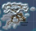
Isle of Ruin.jpg 280 × 241; 13 KB
-
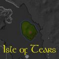
Isle of Tears Map.jpg 318 × 309; 17 KB
-
Isle of Tears.jpg 200 × 200; 31 KB
-
Laesvos Island Map.jpg 179 × 210; 13 KB
-
Lake Lithanen Map.jpg 489 × 373; 28 KB
-
Linvak Mountain Range.jpg 400 × 250; 75 KB
-
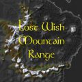
Lost Wish Mountain Range.jpg 300 × 300; 62 KB
-
Lotila Island.jpg 203 × 254; 9 KB
-
Map of Auberean Live.jpg 512 × 256; 67 KB
-
Map of Dereth.jpg 600 × 600; 80 KB
-
Map of Ispar.jpg 675 × 900; 164 KB
-
Map-sep2001.jpg 514 × 534; 54 KB
-
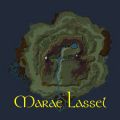
Marae Lassel.jpg 300 × 300; 78 KB
-
Marae Spawn Distribution.jpg 633 × 468; 46 KB
-
Middle Osteth.jpg 700 × 600; 101 KB
-
Miremdae Island Map.jpg 339 × 277; 31 KB
-
Moarsman City Coral Towers Map.jpg 300 × 200; 5 KB
-
Moarsman City Land Mass.jpg 250 × 250; 8 KB
-
Moarsman City Shrines Map.jpg 300 × 200; 5 KB
-
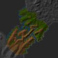
Mount Esper Map.jpg 170 × 167; 9 KB
-
Neftet Potential Device Sites.jpg 400 × 408; 70 KB
-
Northern Landbridge.jpg 300 × 300; 63 KB
-
Northern Osteth.jpg 850 × 496; 137 KB
-
Obsidian Plains.jpg 300 × 300; 101 KB
-
Olthoi Island Small.png 260 × 300; 10 KB
-
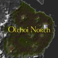
Olthoi North.jpg 300 × 300; 62 KB
-
Original Dereth.jpg 2,041 × 2,041; 627 KB
-
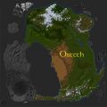
Osteth.jpg 400 × 400; 67 KB
-
Pedestal Lever Room.jpg 216 × 223; 5 KB
-
Plains of Gaerwel.jpg 600 × 530; 97 KB
-
Point Map 512 2009-02.jpg 512 × 511; 56 KB
-
Point Map 512.jpg 512 × 512; 54 KB
-
Point Map.jpg 256 × 256; 16 KB
-
Points of Interest Map.gif 311 × 321; 50 KB
-
River Prosper.jpg 580 × 700; 94 KB
-
Singularity Caul.jpg 260 × 260; 52 KB
-
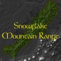
Snowflake Mountain Range.jpg 300 × 300; 61 KB
-
South Direlands Craters Map.jpg 263 × 237; 16 KB
-
South Direlands Craters.jpg 250 × 250; 62 KB
-
Southern Landbridge.jpg 400 × 250; 62 KB
-
Southern Osteth.jpg 600 × 300; 127 KB
-
Spawn Map Base.jpg 256 × 256; 16 KB
-
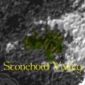
Stonehold Valley.jpg 300 × 300; 57 KB
-
Thesalene Island Map.jpg 256 × 294; 23 KB
-
Traitor's Island.jpg 213 × 267; 10 KB
-
Ulgrim's Island.jpg 200 × 200; 25 KB
-
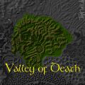
Valley of Death.jpg 300 × 300; 80 KB
-
Vanguard Isle.jpg 198 × 321; 12 KB
-
Vesayen - Avalelle Island.png 199 × 266; 23 KB
-
Vesayen - Ithaenc Island.png 199 × 266; 27 KB
-
Vesayen - Laesvos Island.png 199 × 266; 24 KB
-
Vesayen - MacNiall's Island.png 199 × 266; 21 KB
-
Vesayen - Miremdae Island.png 199 × 266; 23 KB
-
Vesayen - Shadow Governess' Isle.png 199 × 266; 15 KB
-
Vesayen - Thesalene Island.png 199 × 266; 24 KB
-
Vesayen - Xi Ru's Island.png 199 × 266; 24 KB
-
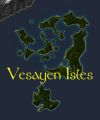
Vesayen Isles.jpg 250 × 300; 64 KB
-
Vesayen Isles.png 214 × 277; 16 KB
-
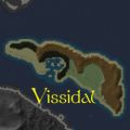
Vissidal.jpg 250 × 250; 48 KB
-
Wisp Lake Map.jpg 168 × 170; 8 KB
-
Withered Atoll.jpg 650 × 875; 98 KB
-
Xi Ru's Island Live.jpg 481 × 464; 72 KB
-
Yaraq Cove.jpg 300 × 300; 28 KB
-
Yushad Ridge.jpg 394 × 517; 47 KB
-
Zogblaster map aluvianrealm.gif 400 × 523; 165 KB
-
Zogblaster map gharukingdom.gif 407 × 698; 214 KB
-
Zogblaster map shonation.gif 410 × 422; 115 KB
-
Zone Downloads townmap.jpg 550 × 550; 87 KB

