User:Widgeon/Big Map of Dereth
Gawa's Big Map

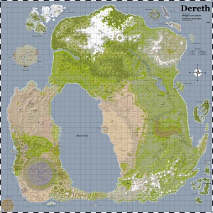
Gawa Ibn Edwas of Solclaim created a big map of Dereth with mansions, villas, cottages, dungeons, towns, lifestones and more labelled on it. This was a 6123x6123 image meant for printing 3'x3'. It looks like he also split this up into 9 and 16 pieces, for easier printing. He last updated his map on 2006-08-06. It is available at http://www.warcry.com/codex/ac/game_info/dereth_maps/.
From an archive of <http://www.thelostcorpses.com/derethmap>:
This website contains information about the Map of Dereth, a highly detailed map of the world of Dereth. Dereth is the ingame world of the MMORPG Asheron's Call. The goal of this map to give an exact overview of all the important items in the landscape - lifestones, dungeons, portals, towns, and so on. The reason to create this map is simple: it's based on "The Map", a map of Dereth hosted by The Crossroads of Dereth. Since this map is rather old (2.5 years) I decided to create my own version.
The data for the map is collected from 2 places: one of the data files of the game (cell.dat) functions as the source for the data to generate the landscape. The location of most items on the map comes from the Crossroad of Dereth Atlas database, which contains information about all locations found on and under the surface of Dereth.
The entire map is generated with my own toolset, written in Java. A part of the code to extract the map from the cell.dat comes from David Simpson's page of Dereth cartography.
-- Gawa Ibn Edwas of Solclaim
Current Big Map
I'm working to create an updated version of a big map of Dereth. The hard part is placing the labels so they don't overlap each other, followed simply by verifying the data to make sure it is accurate. Once I have everything updated, keeping the map up to date should be pretty easy as there generally aren't many changes each patch, and the wiki keeps track of the changes.
The big map update announcements by Lothar seem to be taking place on this thread.
Edition of August 2012 (Version 2012-08-24)
dereth-2012-08-detail-2012-08-24.png
The Map is also available in piece form; 4x4 and 5x5
- Added Venerable Mausoleum, Hoshino Tower and Nanjou Shou-jen Academy dungeons, and updated the terrain around there.
- Added Royal Tent point of interest.
Previous Released Versions of the Big Map of Dereth:
Dereth-2012-07-Detail-2012-07-22.png
The Map is also available in piece form; 4x4 and 5x5
- Added the three new dungeons for the July patch.
- I've updated the colors to be more saturated, and updated diffuse color calculation to make the shadows more prominent. As a result, the colors are a bit darker and the black text was difficult to see, so I'm trying out white text this time.
- I can adjust the light vector and land type colors in real time on the base map. This makes it much easier and faster to make adjustments. Here's a short screencast of me running that app. http://www.youtube.com/watch?v=uykDvR_6h2U
- The pieces now overlap, so they are 4x4 and 5x5.
Dereth-2012-06-Detail-2012-06-30.png
The Map is also available in piece form; 3 x 3 and 4 x 4
- Show most of the minor point of interest labels. There are still too many in places (Holtburg and some other towns, Blackmire Swamp, Caul) to show all the labels.
- Add labels for more of the islands (Vissidal Flagging Islands, Lotila Island, Vanguard Island, Isle of Ruin, Traitor's Island, Xi Ru's Island, Corcosi Island, Count Dardante's Island)
- Add some missing lifestones.
Dereth-2012-06-Detail-2012-06-23.png
The Map is also available in piece form; 3 x 3 and 4 x 4
- Shown icons next to labels in the Features legend.
- Group clusters of dungeons (like Crystal Mines, Bur, Temple Catacombs) together so their labels don't overlap.
- All Points of Interest from the wiki are included. Major points of interest show their label, minor points of interest just show the icon. I might have missed some, like The Deep (Vissidal), where the pages don't have a Map Point.
dereth-2012-06-detail-2012-06-14.png
dereth-2012-05-detail-2012-06-04-test2.png
In Progress
Position labels so they don't overlapTweak the diffuse lighting a bit more- Add portals, portal hubs, and
points of interest - Verify names, locations of dungeons, portals, portal hubs, points of interest
Tweak map generation with actual land height valuesAdd a legend for the icons. Will probably combine with the map features.Chop up into 9 and 16 parts for printing.